Great Allegheny Passage
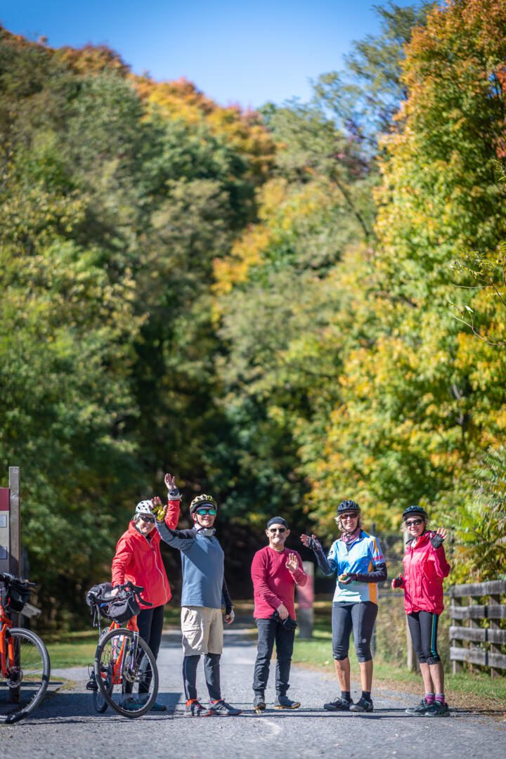
Enjoying the great outdoors on the GAP (Frostburg Trailhead).
“The Ride of a Lifetime” ~ Thirty-Five Years in the Making!
One of eight nationally designated scenic trails, the Great Allegheny Passage connects Pittsburgh, PA to Cumberland, MD. The GAP trail offers 150 miles of scenic and well-maintained rail-trail, ready for your biking or hiking adventure.
Soaring over valleys, snaking around mountains, and skirting alongside three rivers, cyclists pass through the Cumberland Narrows, cross the Mason-Dixon Line, top the Eastern Continental Divide at 2,392’, weave through the breathtaking Laurel Highlands, wind their way through the Ohiopyle State Park, journey through the region’s coke, coal, mining, and steel-making corridor, and end at Pittsburgh’s majestic Point State Park.
Part of a rail trail system in Maryland and Pennsylvania— it is the central trail of a network of long-distance hiker-biker trails throughout the Appalachian Mountains,
In June 2013, thirty-five years after construction first began, the final GAP section was completed at an overall cost of $80 million.
The multi-use trail, suitable for biking and walking, uses defunct corridors of the Baltimore and Ohio Railroad, Pittsburgh and Lake Erie Railroad, Union Railroad and the Western Maryland Railway.
Connecting with the C&O Canal Towpath Trail in Cumberland, Maryland, it makes a continuous, non-motorized corridor from Point State Park 335 miles (539 km) to Washington, D.C.
Great Allegheny Passage
Enjoying the great outdoors on the GAP (Frostburg Trailhead).
“The Ride of a Lifetime” ~ Thirty-Five Years in the Making!
One of eight nationally designated scenic trails, the Great Allegheny Passage connects Pittsburgh, PA to Cumberland, MD. The GAP trail offers 150 miles of scenic and well-maintained rail-trail, ready for your biking or hiking adventure.
Soaring over valleys, snaking around mountains, and skirting alongside three rivers, cyclists pass through the Cumberland Narrows, cross the Mason-Dixon Line, top the Eastern Continental Divide at 2,392’, weave through the breathtaking Laurel Highlands, wind their way through the Ohiopyle State Park, journey through the region’s coke, coal, mining, and steel-making corridor, and end at Pittsburgh’s majestic Point State Park.
Part of a rail trail system in Maryland and Pennsylvania— it is the central trail of a network of long-distance hiker-biker trails throughout the Appalachian Mountains,
In June 2013, thirty-five years after construction first began, the final GAP section was completed at an overall cost of $80 million.
The multi-use trail, suitable for biking and walking, uses defunct corridors of the Baltimore and Ohio Railroad, Pittsburgh and Lake Erie Railroad, Union Railroad and the Western Maryland Railway.
Connecting with the C&O Canal Towpath Trail in Cumberland, Maryland, it makes a continuous, non-motorized corridor from Point State Park 335 miles (539 km) to Washington, D.C.
